Location Intelligence Services for Wind Power Projects
Managing Geographic Information
A Geographic Information System (GIS) identifies and visualizes spatial challenges and opportunities by using data that is linked to a specific location. As a consultancy and tech company, we provide GIS managementto help renewable energy developers plan and construct their projects. Our GIS consultants assist with both the implementation of our GIS platform and other GIS services.
WHAT WE OFFER
GIS Services for Renewable Energy Projects
Project Resources
Our GIS consultants can be allocated as on-site, full-time project resources
Desktop GIS Support & WindGIS Deployment
We help with the analysis, set-up, and technical implementation of your GIS
Spatial Data Management
Let our GIS team centralize all spatial data for your project or organization
Project Deliverables
Upon request, we deliver GIS reports, maps, data, data QC, and DMS integrations
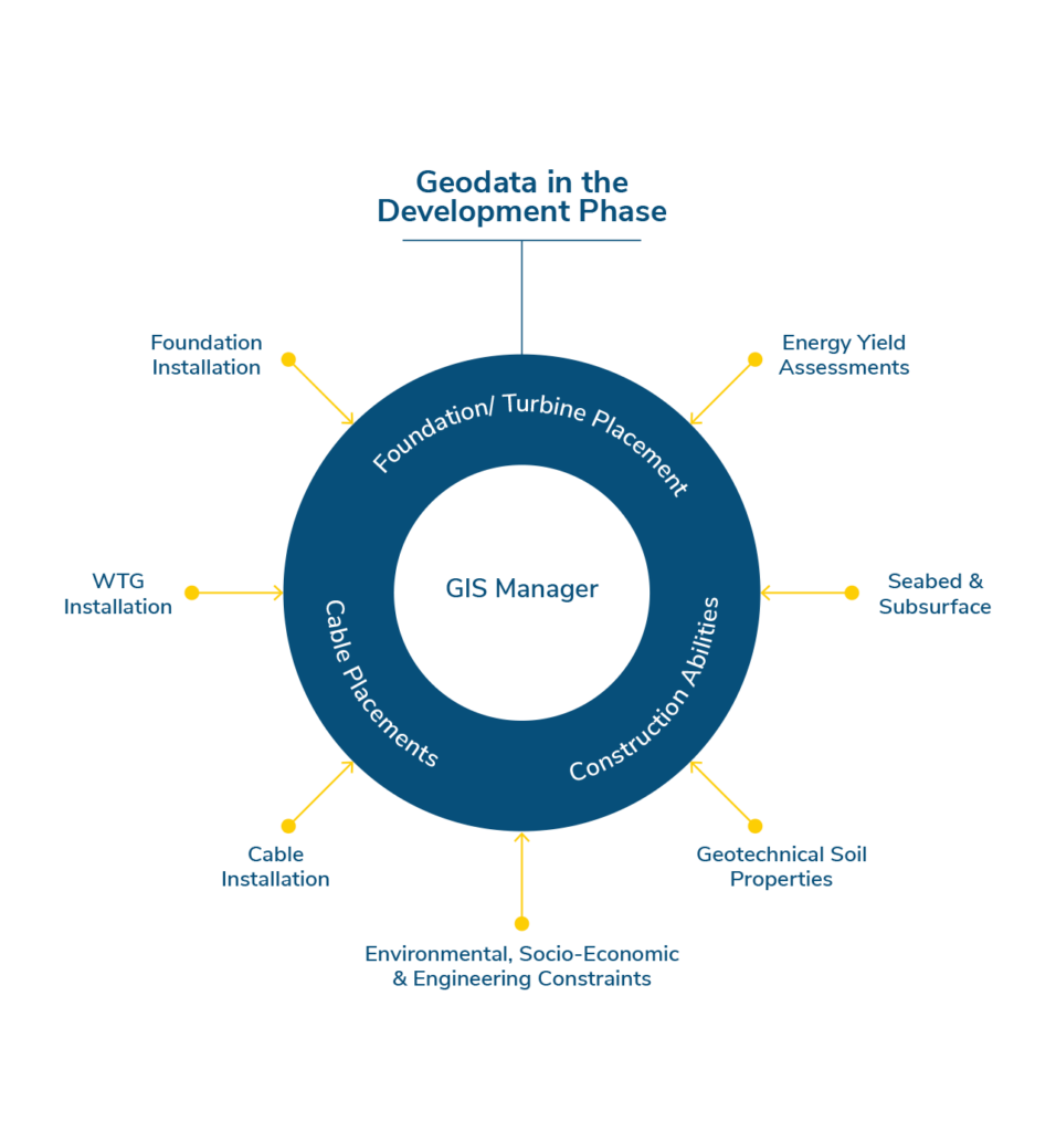
GIS Management in Project Phases
We have extensive GIS knowledge and industry experience, enabling us to support all phases of offshore wind projects. See below what areas our GIS Management service covers.
FEASIBILITY EXAMPLE
Constraint Mapping & Site Selection
Our GIS consultants implement multi-criteria location analyses to help customers identify high potential sites suitable for renewable energy development. We use a combination of publicly available and locally sourced data to conduct these feasibility studies.
DEVELOPMENT EXAMPLE
GIS Scope & Processes
As part of your project team or as support resources for your GIS specialists, our GIS consultants design systems and processes required for developing renewable energy projects. This includes GIS guidelines and procedures, data models, and more.
EXECUTION EXAMPLE
Best Practices for Geospatial Data Handling
We ensure easy and lean data management for safe and on-time offshore operations. Our GIS consultants take responsibility for technical advice and input to tender material/contracts, and more.
We have provided various GIS services to offshore wind development projects in Europe, Asia, North and South America, Australia, and Oceania.
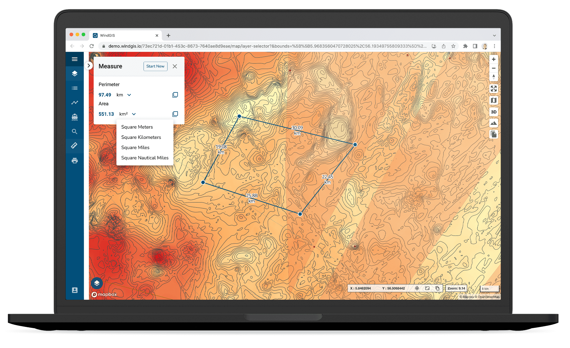
WindGIS
Our Powerful GIS Solution
As part of our GIS Management service, we deliver and manage GIS data for renewable energy projects. To visualize and communicate various datasets, we have developed a GIS solution to view and interact with the data. Use WindGIS for the different phases of your project.